
The parish of West Grinstead, which includes the growing village of Partridge Green, and which is noted for its long Roman Catholic tradition, lies midway between Horsham and the north slope of the South Downs. Though the distinguishing prefix is recorded from the mid 13th century, the parish has no connexion with East Grinstead. The ancient parish contained 6,720 a. in 1881. Between 1882 and 1891 a detached part of Ashurst within West Grinstead containing Upper Posbrooks Farm (37 a.) was added to it. In 1971 the parish comprised 2,733 ha. (6,753 a.). The parish is irregular in shape, especially on the south side where Ashurst parish makes a deep salient within it. In the south-east the boundary is formed by the two branches of the river Adur, which join at the parish's south-eastern tip. In the north and west the boundary partly follows streams. Elsewhere it follows what are evidently old roads: that from Partridge Green to Nuthurst in the northeast, and that from Bramber to Knepp castle and Horsham in the south-west and north-west. Windsor common in the north-east corner of Wiston parish perhaps originally straddled the boundary between Wiston and West Grinstead.
The highest land in the parish, between 100 and c. 160 ft. (30 and 49 metres), is in the north-east, north-west, and south-west parts. The western branch of the river Adur flows from north-west to south-east across the parish and is fed by tributary streams from both sides. The parish lies chiefly on the Weald clay, with alluvium in the valleys, and there are outcrops of Horsham stone and other sandstone beds in the extreme north and north-east. The river Adur was subject to serious flooding in 1797, and continued to be so during the 19th and 20th centuries despite the improvement of its banks after 1807. It was tidal in both branches in the south-east corner of the parish in 1984. In the Middle Ages much of the parish was presumably covered by woodland. By 1830, however, woods, hedgerows, and shaws were estimated to comprise less than a sixth of its area, and in 1983 the parish was much less wooded than the surrounding country to north and south. The Lock estate included c. 228 a. of woods in 1984. Jolesfield common and Partridge green in the east remained uninclosed waste until 1872.
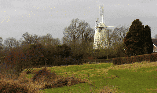
Parkland has been extensive in the parish since the Middle Ages. The two chief parks, Stock park in the west, recorded between the 13th century and the 16th or 17th, and the park attached to West Grinstead manor house, recorded between the 16th century or earlier and the 20th, are discussed below. In addition, the new gentlemen's houses built afterc. 1800 often had parkland attached, and there was parkland in the parish belonging to Shermanbury Grange by 1896; in 1982 it still adjoined Partridge Green village on the east. Parkland and park-like farmland were dominant in the landscape in the mid 20th century; in 1965 West Grinstead and Shipley together were described as 'the Weald ... tamed, then let back, on a leash as it were, to be wild within limits'.
Early medieval settlement in West Grinstead, as elsewhere in the Weald, was scattered. Some sites originated as pasture places for manors in the south part of Bramber rape, while the farm name Bowshots contains the element scydd which describes huts built as the seasonal dwellings of herdsmen.
The name Grinstead was recorded as the hundred name in 1086, and was apparently transferred later to the vill and the parish. The surname 'of Grinstead' occurs locally c. 1230. A village of Grinstead was mentioned c. 1260, but there is no evidence for a nucleated village. The only dwellings known to have existed near the church are Glebe House to the east and two buildings that stood beside the churchyard, one of which was used as a shop in the 17th and 18th centuries; the manor house lay 2/3 mile (1 km.) to the north. Glebe Cottage, on the north side of the churchyard, is apparently a 17th-century building, with exposed timber framing in its northern outshut. The symmetrical south front with end chimneys was added in the 18th century; at the same time, apparently, the plan of the house was altered to give a central staircase flanked by two rooms. A one storeyed red brick range running north-south was built on the north-east side in the 19th century to serve as a school; originally separate, it was later joined to the house. The main range was extended eastwards in the 20th century, when various fittings brought from elsewhere were inserted in the house, and the shell hood was added over the entrance doorway. Across the river south of the church are Fosters, a timber-framed building apparently of the 17th century or earlier, with a possibly 18th-century brick barn to the south, and Butcher's Row, a group of 19th-and 20th-century estate cottages. The other vill recorded in the Middle Ages was Byne, which lay partly in West Grinstead and partly in Ashurst; again, no nucleated settlement can be shown to have existed there in West Grinstead.
The sites of some medieval farms can perhaps be inferred from modern farm names corresponding to medieval surnames recorded in the parish; examples are Chuck's, Fuller's, Hobshort's, Lloyts, Need's, Posbrook's, Thistleworth, and Tuckmans farms. Pinland farm was also recorded before 1500; it, Hobshort's, Thistleworth, and Brightham's farms all occupy knolls, like many others in the Weald clay country. Many isolated farmhouses in the parish are of the 17th century or earlier, and many that are post-medieval may occupy the sites of earlier buildings. Well Land Farm north of Partridge Green is a four-bayed hall house with crown-post roof; into the hall were inserted first a smoke bay, and then a central chimney. Rookland Farm east of Dial Post includes a three-bayed medieval range, probably a cross wing to an earlier house now destroyed. Sand's Farm nearby and Tuckmans Farm in the north-west corner of the parish are basically 16th-century, but the former has a medieval cross wing. Lloyts Farm, probably of the early 17th century, is a timber-framed house of three-room plan with a slightly later rear kitchen wing.
In the 18th and 19th centuries many new houses were built along the main roads of the parish, benefiting from their improvement under turnpike trusts after 1764. The chief areas of settlement at that time were the three adjacent hamlets in the east, Jolesfield, Littleworth, and Partridge Green, and the hamlet of Dial Post in the west.
A tenement called Jolesfield existed in 1590, and Jolesfield was a road destination in 1535 and 1635. Some farmhouses of the 17th century and earlier surround what was uninclosed common land until 1872. Blanches, near the south-east corner of the former common, is a late medieval house of four bays with a two-bayed central hall. In the late 16th or early 17th century an upper floor was inserted into the hall and a chimneystack added on the rear wall. The two-storeyed oriel on the front of the building is 17th-century, but may represent an older form. At Joles Farm, south of the common, the probably 16th-century main range also had a central open hall of two bays; by c. 1600 an upper floor had been inserted and the south end remodelled, two external brick chimneystacks being built.
At least one building described as a cottage existed on or beside the common in the early 18th century; surviving buildings at Jolesfield of the 18th and early 19th centuries include the old Green Man inn at the south-west corner and buildings on the north side which housed workers at the Jolesfield brickworks. About 1840 there were 15 or 20 buildings around the common. The hamlet of Littleworth lay at the north-east corner of the common along the road to Nuthurst; some buildings of before c. 1800 survived there in 1983. One or two other buildings were put up at Littleworth before c. 1840.
About ½ mile (800 metres) south of Jolesfield common, houses began to spring up by the 18th century beside Partridge green, a strip of waste land along the road which leads from the Horsham-Steyning road to Shermanbury and which became Partridge Green High Street. By c. 1800 there was a group near the junction of the two roads, besides other buildings both south of that junction and east of the green towards the Shermanbury boundary. Some 18thcentury or earlier buildings survived in all three places in 1983.
Building continued at Partridge Green in the earlier 19th century, and by c. 1840 there were c. 6 buildings at the road junction, including an inn. The settlement expanded much faster after the arrival of the railway in 1861 and the inclosure of the green in 1872. Shortly before 1867 some new cottages were built by small proprietors near the station; having two bedrooms they were superior to the general standard of cottages elsewhere in the parish at the time. Some grander Italianate stuccoed houses in South Street off High Street are contemporary. Further houses had been built in both streets by 1896, and by 1909 there was building along most of High Street between the Horsham-Steyning road and the edge of the park belonging to Shermanbury Grange. Building land was offered for sale north of High Street in 1907 and 1911; at the latter date there was claimed to be a good demand in the area for houses and cottages of moderate size.

No comments:
Post a Comment